Sill Lake Lead Silver Project
Sill Lake Lead Silver Project
Sill Lake Lead Silver Project
Ownership: 100%
Commodities: Silver, Lead
Location: Sault Ste. Marie , Ontario
Status: Advanced Exploration, Historic Resource
Next Steps: Follow up of Aster Survey recommendations and update NI Reports
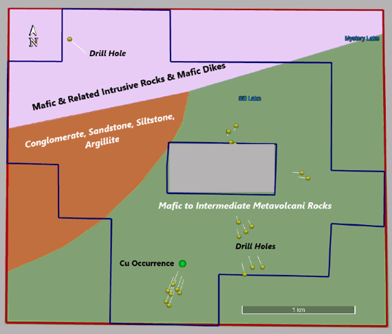
The Sill Lake Claims are located approximately thirty (30) kilometres north-northeast of Sault Ste. Marie in Vankoughnet Township in the Sault Ste. Marie Mining District of Ontario. The Sill Lake Property is comprised of fifty-seven (57) contiguous Mining Claims totaling 1,155 hectares.
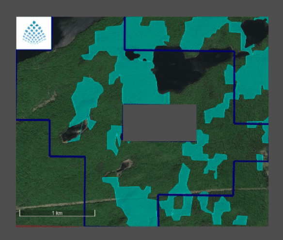
In 2010, the then owners of the Sill Lake Property sold the property to Argentium Resources Inc. In 2012, this company announced results of three massive galena samples from the Sill Lake silver-lead vein, which returned between 5.4% to 8.4% lead; 2.4kg/t to 7.6 kg/t silver; 0.4% to 6.5% copper, and 0.31 g/t to 0.44 g/t gold. Tartisan undertook an Aster Funds Ltd spectral analysis and synthetic aperture radar remote sensing surveys during the quarter which involved a Target Vector Mineral (TVM) analysis of key indicator/pathfinder minerals for silver, gold and base metal exploration.
During the year ended March 31, 2021, the Company purchased a 100% interest in certain claims in the Sault Ste. Marie Mining District in Ontario to complete the Sill Lake lead-silver property package. The Company paid a cash payment of $75,000; issued 100,000 common shares of the Company, and a 2% net smelter return royalty (subject to a 1% buy-back provision for $250,000) has been paid and assigned in consideration to the vendors.
The Company had retained SMX International Corp. to update the NI 43-101 Resource Report in fiscal 2020-21. A site visit occurred by geological consultants in November 2020. On May 11, 2021 The Company filed the Updated Sill Lake Resource Report on SEDAR+.
In June 2022, the Company reported the airborne high resolution MAG Survey for the Company’s 100% owned Sill Lake Lead-Silver Property has been completed. The high-res MAG survey covered approximately 297-line kms and used a 50-meter line spacing.
The Sill Lake Deposit is associated with a northwest-southeast trending magnetic low feature in the survey data. Interpretation of the data suggests the structure which hosts the known Sill Lake Ag-Pb resource extends approximately 2 kilometres to the southeast and appears to be extending to the northeast offset by a series of interpreted faults. A two- kilometer extension is prospective and worthy of follow up and potentially a new exploration and drill program. The results led to staking an additional 10 claims (now a total of 57) to cover the interpreted structure.
The Project has seen two distinct periods of underground development and production


